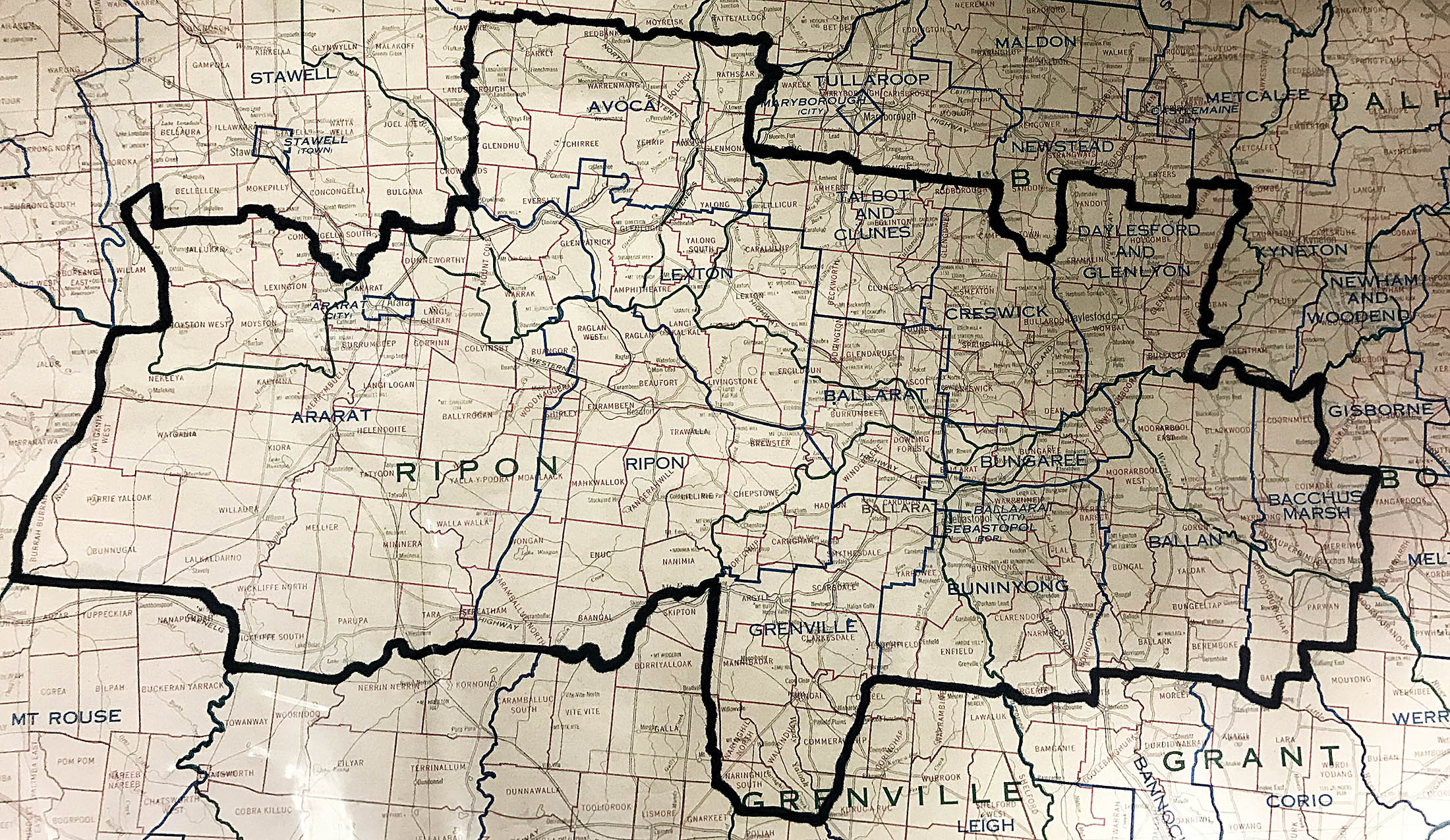
Ballarat is a major regional city in the Central Highlands of Victoria about an hour's drive along the Western Freeway from Melbourne. Central Ballarat consists principally of Ballarat East, Ballarat West and Sebastopol and for these we have many indexed records. However the geographic area of The Ballarat & District Genealogical Society extends from Ballan in the east to Ararat in the west. Historical mining and farming communities to the north and south of Ballarat are included in our research area although we can refer enquiries to those local societies which we know to be active. To the south we have the townships of Linton, Smythesdale, Rokewood and Buninyong while to the north we have Avoca, Clunes, Creswick and Daylesford as well as many dozens of smaller rural localities. The early goldfields populations were mobile going from one rush to another so our research team is experienced in tracing those who moved on although this may prove to be a challenge.
The 1869 Ballarat Directory by John Swindler includes Black Lead, Buninyong, Bungaree, Burrumbeet, Cambrian Hill, Cargarie, Cherry Tree Flat, Cobblers, Corduroy, Dead Horse, Dog Trap Creek, Durham Lead, Ercildoun, Fellmongers, Green Hill, Hardies Hill, Learmonth, Little Bendigo, Lal Lal, Miners Rest, Mount Clear, Mount Mercer, Napoleons, Ross Creek, Sebastopol, Springs, Scotchmans Lead, Stony Rises, Warrenheip, Windermere.
These places would have been familiar to people at the time but some place names have lapsed into disuse.